More context on the climb.
See altitude, vertical speed, ground track, groundspeed, and distance to your marked landing zone.
Not sure with your choice? Need help choosing? Just send us a message! We are here for you.

Deep & Steep · GPS altimeter

From boarding to landing
Insight measures altitude using air pressure. Its integrated GPS adds flight data, spotting assistance, and tracks you can review after landing.
See altitude, vertical speed, ground track, groundspeed, and distance to your marked landing zone.
Use large altitude digits, or configure navigation fields for more information. Choose feet or meters.
Choose data such as current glide, glide required, vertical speed, and direction to the landing zone.
GPS fields need a signal; landing-zone information also needs a saved LZ. Explore the display options ↗
Deep and Steep app · iOS & Android
Bring your logbook and GPS tracks onto your phone. Explore your flight, review your canopy, and prepare for the next jump.


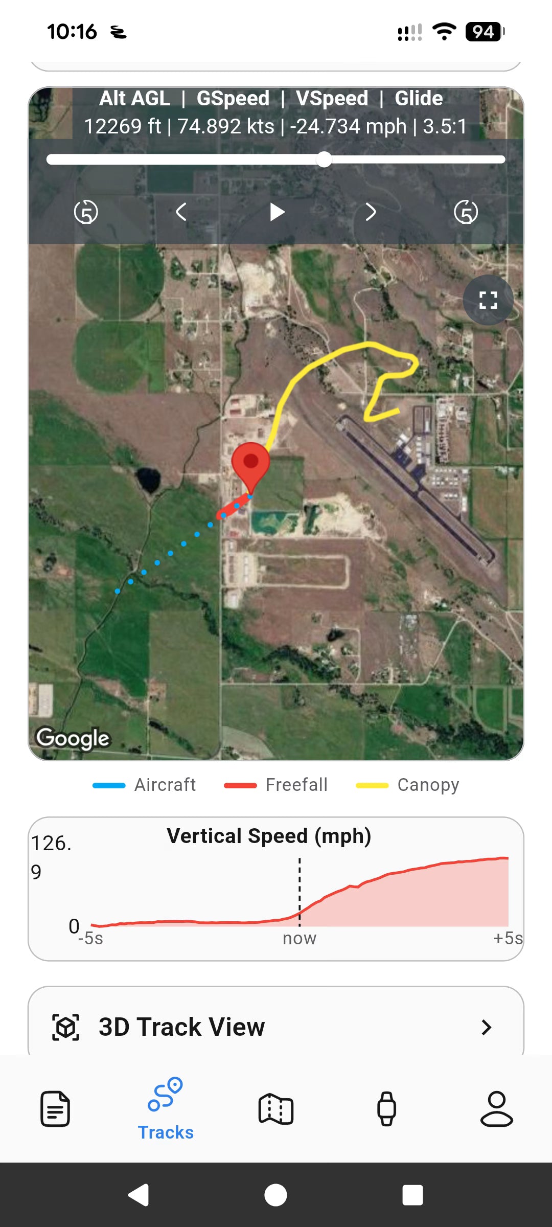
Your recorded jumps, mapped alongside the flight data.
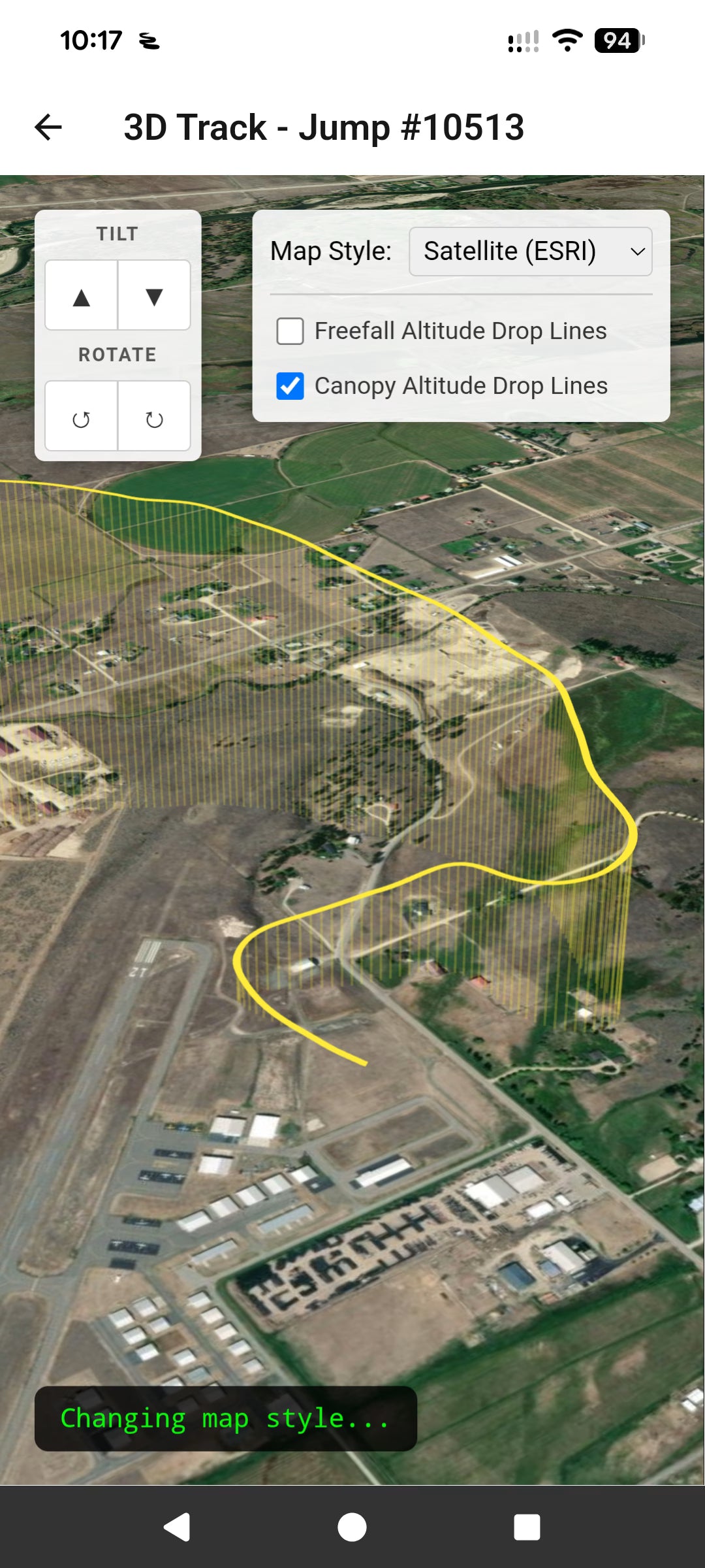
Explore your canopy flight in 3D, from opening to landing.
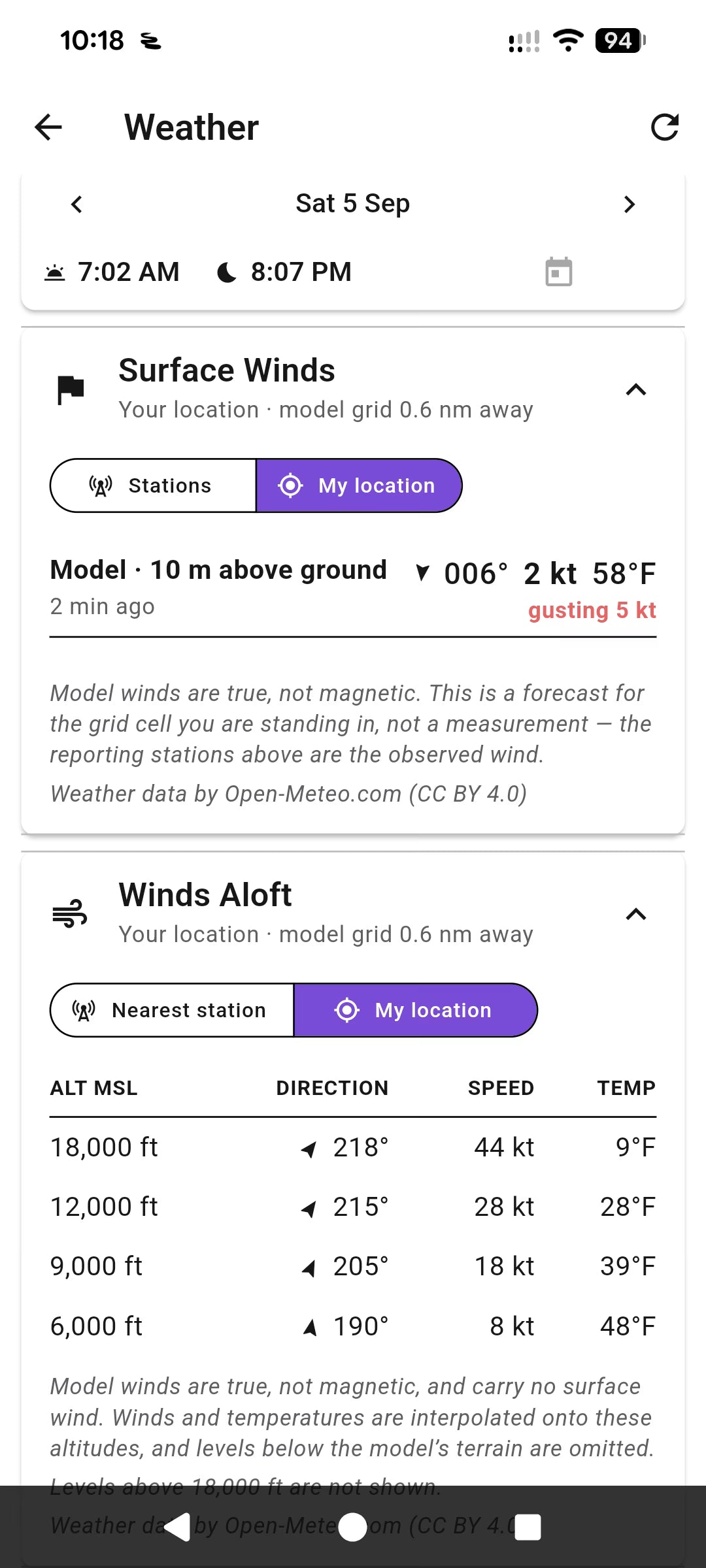
Check weather and winds aloft as part of preparing for your day.
See it in use
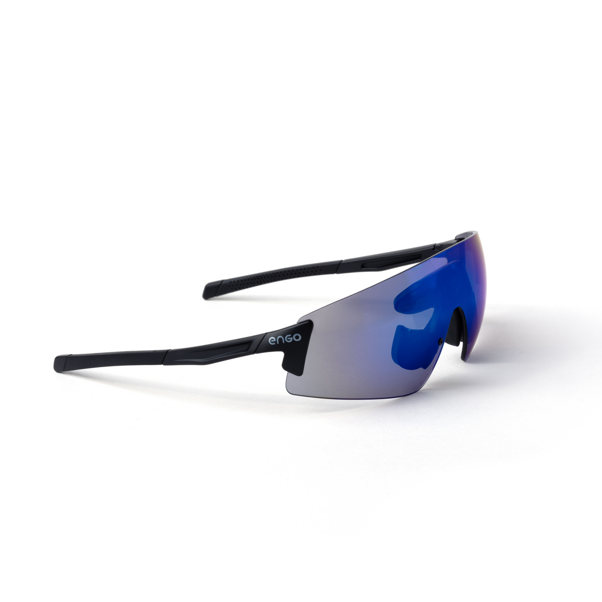
Optional ENGO 3 HUD glasses
ENGO 3 glasses put a small heads-up display in your field of view. Connect them wirelessly to Insight to see altitude and selected GPS flight data without looking down at your wrist.
Keep Insight’s own screen visible and accessible as your primary visual altitude reference. Deep & Steep recommends a USPA B license or equivalent for HUD use.
Connection and display guide ↗Optional SoundLink audible
Choose tone alarms or spoken altitude announcements. SoundLink works independently as an audible, with up to four freefall and four canopy alarms and four saved presets.
Insight supports one active wireless accessory connection. If ENGO glasses use that connection, SoundLink can still provide standalone altitude alerts, but not Insight’s GPS announcements.
Insight specifications
Check the manufacturer’s manual for setup, care, firmware, and operating instructions.
Read the official manual ↗Before you order
Mounts, glasses, SoundLink, and the app: what you need to know to choose your setup.
The listed base price is for the altimeter. Add a wrist mount, hand mount, adjustable strap, or Wedge adapter above. Choose “No mount” if you already own a compatible mount. The Wedge adapter does not include the Wedge mudflap mount.
Choose your wrist mount by wrist circumference, measured with your usual jumping clothing on.
| Wrist size | Wrist circumference |
|---|---|
| Small | 15 cm / 5.9 in |
| Medium | 17 cm / 6.7 in |
| Large | 19 cm / 7.5 in |
| XL | 20 cm / 7.9 in |
| XXL | 22 cm / 8.7 in |
Between sizes? Use the measurement over your actual jumping layers, especially if you wear thick clothing beneath the mount.
No. Insight works as a standalone visual altimeter. The app is for configuration and reviewing recorded data.
Sync your logbook and recorded GPS tracks, review flight paths and data, explore a 3D canopy view, check weather and winds aloft, and configure supported devices. It is available for iPhone and Android.
Guest Mode does not send data to the manufacturer’s cloud, and synced logbook and tracks are removed when the app closes. Sign in to retain cloud data. Storage limits apply; check the current account options in the app. Unlimited storage is not included with the altimeter.
Connect using Insight’s App Connect mode, choose GPS Tracks Sync in the app’s Device menu, and transfer the jumps you want. Open a synced flight from Tracks or a logbook entry with a GPS icon. USB CSV logbook access is also available.
Regular tinted styles are for bright conditions: Azure, Dawn, Stride, and Kenya. Photochromic styles, Shadow and Aurora, adapt to changing light. The photos above show the actual frame and lens style; choose your pair in the setup selector to update the price.
Insight supports one active wireless accessory connection at a time. You can use the ENGO HUD alongside SoundLink’s independent altitude alarms and voice announcements. SoundLink’s additional GPS announcements require switching the active Insight connection to SoundLink.
No. SoundLink provides its own altitude alarms and spoken altitude. Connecting Insight adds GPS feedback, and the app or Insight can configure the audible. SoundLink is not water resistant; keep its speaker openings clear of water, dirt, and sand.

The Deep & Steep Insight is a digital skydiving altimeter, GPS data recorder, GPS feedback device and electronic logbook in one compact unit. It is built to be simple to use during the skydive, while still giving you useful GPS and logbook data after landing.
Insight can also connect wirelessly to compatible HUD glasses powered by Engo, giving you a heads-up display option for freefall and canopy flight. Mounting options are sold separately — choose the wrist mount, hand mount, adjustable strap mount, or mudflap adapter depending on how you want to wear the device.
Important: mounting options are sold separately. Please add the required mount to your cart separately.
Insight has integrated GPS and automatically records your track during each skydive, so you can focus on your jump instead of managing a separate GPS device. There is also a manual recording option, so the device can be used for other activities where GPS data is useful, such as BASE, speed flying, paragliding, or similar sports.
Saved GPS track files can be imported into common viewing programs. View a sample GPS track file.
In the aircraft and under canopy, Insight can show useful information to help you make better decisions. Available GPS feedback includes heading over the ground, groundspeed, glide ratio, distance to your marked landing zone, direction to the landing zone, and more. The goal is to make the jumper more informed without adding unnecessary distraction.
Insight currently connects to ENGO 3 HUD smart glasses. Deep & Steep also notes that additional peripheral apps and devices are planned to wirelessly connect to Insight.
For normal weekend skydiving, the manufacturer estimates roughly 4 weeks of use before needing to charge. If jumping every day, Insight can last approximately 10–16 days. Battery life depends on which functions are used — features such as display lighting and GPS recording drain the battery faster.
Insight is water ingress tested for 30 minutes at 1 metre depth. It is suitable for normal skydiving use and water exposure, but it is not intended for scuba diving.
Insight charges via USB-C. When connected to a computer or phone in USB Connect mode, it also acts as a USB file system, allowing access to saved logbook and GPS track files.
If you forgot to charge the altimeter, approximately 20 minutes of charging can provide enough battery for the rest of the day. A full charge from 0% to 100% takes about 1 hour 30 minutes.
The latest 20 skydives can be viewed directly on the Insight logbook screen. The full logbook is stored as a comma-separated file and can be opened on a computer or phone by connecting the device with a USB cable.
In USB Connect mode, Insight appears as a drive. The full logbook can hold 60,000+ skydives and can be viewed in spreadsheet programs or compatible logbook software, together with all saved GPS track files. View a sample logbook file.
Insight automatically shuts off 14 hours after it was turned on for the day. This saves battery and can extend shelf life by more than 50%. The device will not shut down unless it is at ground level when the 14-hour limit is reached.
Insight automatically enables the display light when ambient lighting is dim or dark. The night light turns on when the altimeter detects descent in freefall or under canopy. It is not enabled by default while sitting on the ground, which helps save battery.
Pressing any button temporarily lights the screen for 15 seconds in dim light. There is also a menu option to keep the light on permanently if the automatic feature is not appropriate for a specific skydive.
Mounts are sold separately. Compatible mounting options include:
If you are not sure which mount or setup you need, contact us before ordering and we will help match the Insight to your preferred mounting position.